Water Map Live - Holland
- Publisher: Martijn de Meulder
- Genre: Navigation
- Released: 25 Jul, 2018
- Size: 243.1 MB
- Price: FREE!
 Click here to request a review of this app
- App Store Info
Description
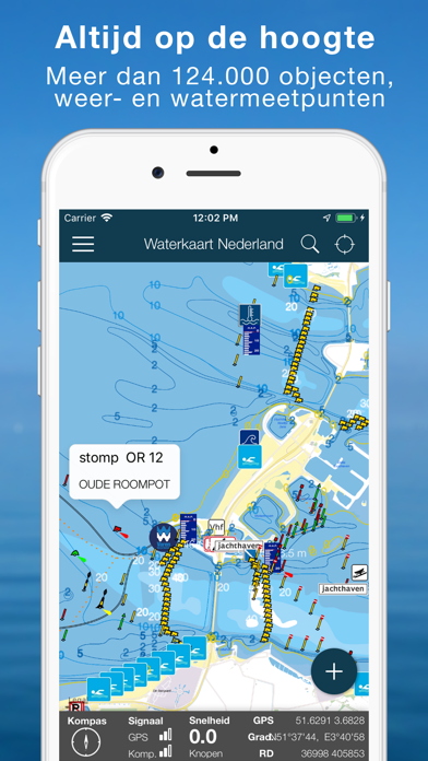
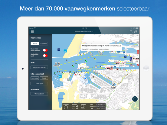
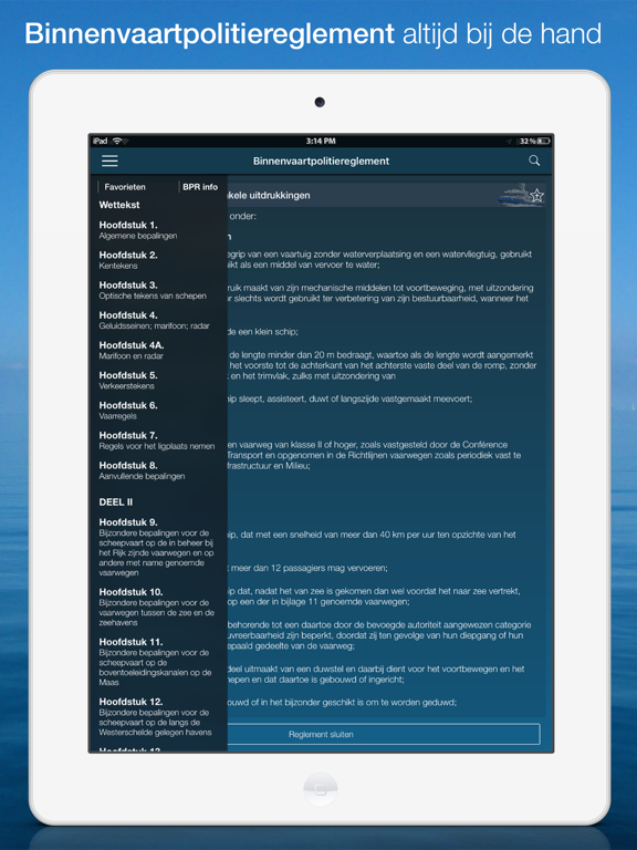
This the most complete water map for the Netherlands. Containing all water way demarcations, traffic signage and live bridges + locks information: opening times, phone numbers and VHF channels.The app also contains hundreds of water level measurement points, live water heights, tidal curves, the current weather at sea, fairway depths, SAR rescue contact information, live AIS ship positions and water quality measurements for swimming.
Thanks to GPS, you can also read out your current speed, and coordinates when sailing.
Water map Holland is largely usable offline, live bridges & locks info, current water heights, temperatures and weather, though, require an internet connection. That is is also the case for the current Notices to Skippers.
PLEASE DO NOTE: this app is using the Dutch language.
The app contains an in app subscription purchase.
- This purchase unlocks all the features of the app for a full year and:
- Costs €4,99 each year.
- Payment will be charged to your iTunes Account at confirmation of purchase.
- This in app subscription will be automatically renewed each year until you cancel the subscription yourself, at least 24-hours before the end of the current period.
- Your account will be charged for renewal within 24-hours prior to the end of the current period, the costs of renewal is also €4,99
- You can manage your subscriptions and turn off auto-renewal by going to the Account Settings on your device (after purchase).
- The terms of use and privacy statement of Surfcheck is also applicable on this in app subscription, please refer to http://surfcheck.info/privacy.php?lang=en to review them
Disclaimer:
We do our utmost to deliver you the best software and data available in the market, but of course we cannot guarantee the proper functioning or accuracy of both. Data sources can change over time. You can not derive rights from this information. By downloading and using Water map Holland you accept these terms.
Location:
The location permission is necessary to enable the app to show you your location and present you with local maritime and weather data. It is used nor stored for anything else at all.
What's New in Version 5.6
5.6 - Midsummer update: all objects on the map have been completely updated again.- You can now also add trailer slipways yourself via the button 'Improve the map' (see the round blue button at the bottom right)
- Notices to Skippers are now also shown directly in the bridges and locks windows.
- At the swimming locations, it is now also shown when the last check of the water quality was carried out.
- From now on you can directly report corrections for the data of Bridges and Locks via the integrated Vaarmelder (see the orange link at the bottom of the window of a bridge or lock).
- The route line is slightly more elegantly designed and less prominent on the map.
- The route planner now also works on the (Euris) main waterways in Belgium, Germany, France and Luxembourg.
- Various improvements in the English and German translations.
- And of course some minor bug and layout fixes. Thanks for the notifications!


